old news from the Grimes family

Category: Trail Journals (Page 4 of 5)

Buffalo Peaks Wilderness

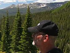
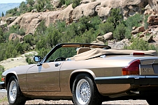
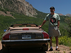
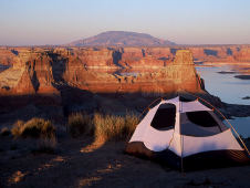
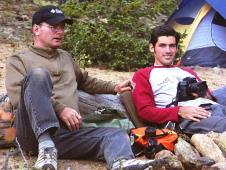
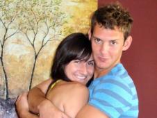
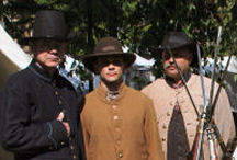
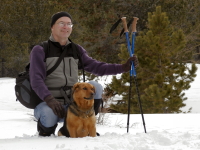
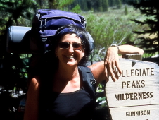
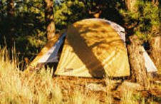
gee… the site has been neglected for awhile. We finally got out and did a little camping last weekend. Josh, Ronda, and I packed up the Jeep and went in search of some 4-wheel drive roads to get away from the traditional campground scenario. We headed over toward Buena Vista and worked our way up some pretty rough roads toward the Buffalo Peaks. It was gettting late and we finally ran out of road around 11,500 feet. Josh got out and started exploring trying to find a good camp site.

He found a real winner but it was a half-mile or so into the woods. We all grabbed as much as we could carry and hiked in. It was a beautiful spot and we left Ronda there to set up the tent while Josh and I went back to the jeep for another load. On the way back we found a jeep trail that looked like we could use to get a little closer to the campsite so we carefully guided the Jeep up this trail. By now it was dark.

We grabbed a bunch more stuff and headed toward the campsite. Or so we thought. It did not take long to become hopelessly lost in the woods in the dark. It’s rather embarrassing to admit but we literally stumbled around for an hour or so dragging along a bunch of gear and getting a bit annoyed. Finally, through a little celestial navigation (North Star) and the ol’ “Marco” – “Polo” trick we made our way back to the campsite. We had a good laugh afterwards and dubbed it our “sherpa training”.

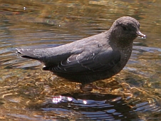
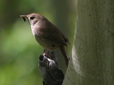
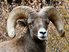
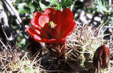
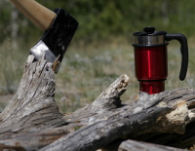
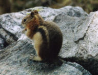
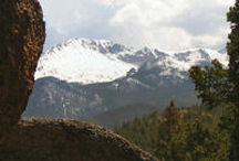
We finshed setting up camp and then enjoyed some very nice stargazing before retiring. It got a bit cool during the night and sleep was elusive for me. We really need to get some decent gear. We had a visitor or two by our tent early in the morning but never actually saw what it was. Most likely an elk. After breakfast we went on a short hike to gain enough altitude that we could see the continental divide which was just west of us. Then we relaxed in camp until we unanimously decided to pack up and go home. The weather was suppose to turn rainy (which it did) and we felt we had enough fun for this weekend.

Oil Creek Tunnel

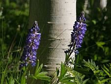
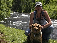
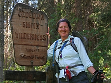
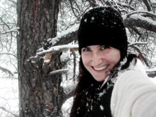
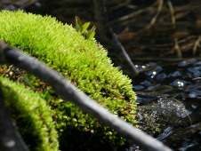
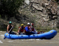
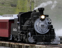
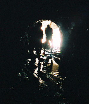
We finally got back to our mystery hike over Fathers Day weekend. Enough snow had melted that we were able to make our way all the way to Oil Creek Tunnel. Kristina came with us as she was home for a visit. She rode the Amtrak train out from Osceola to Denver and spent the weekend. It was great to have her home and back out on the trail with us again.

Oil Creek Tunnel was constructed in the late 1890’s by a Cincinnati company as a prospecting venture. No, not for gold, but for flourine quartz. The tunnel bores straight into Pikes Peak right at the treeline at an elevation of 11,285 feet. It was not a particulary successful operation and they gave up after boring through 1,593 feet of solid granite. The tunnel is about six feet high and eight feet wide for the most part but there are sections that are lower and it’s easy to bonk your head since most of your attention is on where you are putting your feet.

We had a nice hike into the area and were able to find the cabin ruins without much trouble. But beyond the cabin the snow was still drifted pretty heavily and was not passable in many places. We knew the tunnel was in the rock face so we split up and started looking for it. Ronda was the first to spot it and we all converged on the area. The tunnel itself was still covered by the huge snow drifts coming down off the mountain, although there was a small hole from where the warmer air had melted through. The main giveaway was the old steam boiler that is still intact and the stream coming out of the snow. Continue reading

A New Trail

We ventured out on Memorial Day weekend to reconnoiter a new trail that leads to an interesting destination. The destination shall remain undisclosed at the moment since we were unable to complete the trip. The trail begins at the 12,000 ft level on the slopes of Pikes Peak.

At this level you are just entering what is called the “alpine zone”. Another way to look at is “the treeline”. The trail starts out through a wooded area and we soon encountered what would ultimately force us to turn around… deep snow on the trail. Most of the snow is gone but it is still drifted in many places up to 3 or 4 feet deep. Trying to walk over these places in your trail runners can get pretty dicey. We were able to walk over most of them but still sank through in a lot of spots. Abby fared some better as she is a lot lighter but even she had troubles. Needless to say, our feet were soaked by the time we got back to the Jeep.

The trail comes out of the woods and crosses a large scree field, shown in the picture above, and then passes through more snow drifted woods before descending down the back side of the ridge. Here the trail descends swiftly and comes out in a flat area between the two ridges. The trail forks here with one segment going around the opposite ridge and joins up with the Barr trail that many people use to climb Pikes Peak. The other segment (the one we wanted) was buried under lots of snow and we really could not quite pick out where it went. We saw some tracks made by someone with snowshoes but trying to follow those was hopeless. So we turned around.

On the way back up the trail we saw some abandoned mining gear (hint) laying beside the trail. We made our way back through the snow drifts and partway across the scree field and decided to explore an interesting rock outcrop for a good lunching spot. We were successful and had a nice bite to eat and rest while taking in the view down the valley. On the way back up and across to the Jeep a snow squall came along and pelted us with snow! It was short-lived but fun.

Where’s Waldo?

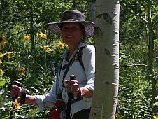
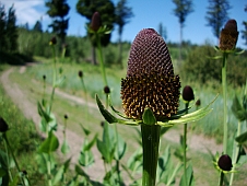
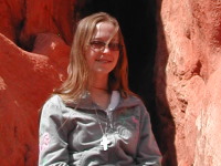
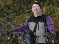
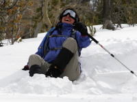
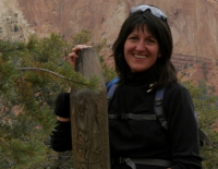
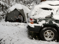
Unless you have a case of blindness you’ve noticed that I “winterized” the look and feel of the site. This seems appropriate since it looks more wintery around here at the moment. Ronda twisted my arm this weekend and we went hiking. I wasn’t overly excited by the prospect since all I have to put on my feet are my trail runners, which are awesome in warmer weather but not worth a hoot on icy surfaces. I’ve put off buying any “gear” as we have more important things to spend our limited funds on at the moment.

So… off we went to Waldo Canyon which is just west of the Springs up Hwy 24 a bit. Abby was thrilled to no end as she has been stuck in the house quite alot lately. The early portion of the trail climbs up along the highway so there is a noise factor but fairly quickly you turn the corner and head in towards Rampart Range and the traffic noise disappears. The sun was shining and temps were in the low 50’s with a mild breeze now and then. The trail was anywhere from 50-100% snow and ice covered but was well packed down. There were already 8 or 10 cars in the parking lot when we got there and it was full when we returned.

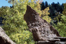
My shoes did not turn out to be quite the disaster I was thinking and I got along pretty well. The trail winds around a bit and after a few miles descends down into the canyon which is fairly broad at the bottom. There are plenty of trees and boulders to keep things interesting. The trail splits and forms a 3.5 mile loop at that point. We decided it would take too long to hike the whole loop so after consulting the map decided to take the more arduous right fork which climbed up to a very nice scenic overlook. We went off-trail aways, stomping through some knee-deep snow to get to some exposed rocks out on a point.

Abby developed an interesting plunge-leap-plunge technique which got her past the deeper parts. She was not about to be left behind and gets annoyed when she is not “out-in-front”. We relaxed on the rocks, soaked up some sunshine and had a little snack before we turned back. The return trip was uneventful. The picture of the snow-covered Pikes Peak at the top of the website was taken along the trail.

It was good to get out into nature again and I have to remember not to get complacent.

The Crags

I was going back through my trail journal and realized I never got the Crags trip up on the website. There were actually two trips to the Crags. One successful and the other not quite so. It was our neighbor Jerry who first told me about the Crags. The trailhead is located on the Crags Campground which is off Hwy 67 a few miles south of Divide, CO. There is a long access road from the highway that runs up to the campground. It is pretty rough and narrow at spots but a 2WD car would have no problem getting up there.

Our first attempt at finding the trail was a bust. You actually have to go through the campgrounds to get to the trailhead. The map I had was a little vague and we went past the campgrounds and started out on a different trail that runs down through Putney Gulch. We hiked for an hour or so and finally decided that we must be on the wrong trail so we turned around. After making a little more detailed examination of the map I figured out where I went wrong and we went back to the campground.

We had lunch at the campground and I convinced everyone that we should at least check out the real trail even if we didn’t go all the way to the end. This wasn’t an overly popular decision but we all went far enough to see the beauty of the area even if we did not make it to the end where the “awesome view” is supposed to be. That would have to wait for another day.
Continue reading

Stanley Canyon

Kristina and I went on a hike with Abby last Sunday. We went to the Saturday night service at church so we could skip out on Sunday morning. 10 o’clock found us cruising through the gates at the Air Force Academy and heading for the Stanley Canyon trailhead. This is one is rated difficult. It did not disappoint either.

The trail does not fool around. It maintains a steady climb up through rocks and loose granite. You don’t walk up this trail, you climb. There are a few places along the way that provide a nice overlook of the Academy grounds but mostly you stay in the trees. Towards the top you start running parallel to the stream coming down the canyon. Abby promptly laid down in the cold water and and had a big drink.

After climbing 1,200 feet or so you reach the top and it levels out as it winds into the foothills. You pass through a small meadow and finally reach the reservoir. We had just caught up with a group of people when another group caught up with us so there were three groups of people, all with dogs, that arrived together. We all went different directions at the reservoir so we were quickly alone again. We decided to head off-trail, up a little valley, and then followed a ridge line looking for a place with a view to eat our lunch.

We eventually found a nice granite outcrop with a view of Pikes Peak and had our lunch. We wandered around in the woods for awhile taking in the beauty and shooting a few pictures. We took our time going back but continued to run into more groups of people coming up. Overall, I think we met or passed 10 or 12 different groups. The trip back down the steep trail went much faster but in all reality was almost worse than going up. My knees were hurting by the time we got back down and several times we barely avoided a nasty fall. I don’t know that I’ll be going back to that trail real soon.

I am pleased with the photos I got, well at least some of them, and I continue to get a little smarter each time I go out.

Fall in the Moutains

Several of the neighbors have been suggesting we take a drive over towards Cripple Creek and see the aspen trees in their fall colors. We decided to incorporate that idea with a hike I have been wanting to make on the western slopes of Pikes Peak. South of Divide along Highway 67 almost to Cripple Creek is the trailhead for Horse Thief Falls (HTF) and Pancake Rocks. HTF is the more popular hike but I’ve seen plenty of falls lately and since it seems to predominately stay in a narrow valley I didn’t figure there would be much of a “view” and I was definitely after a “view” so I could try out my new telephoto lens.

The Pancake Rocks trail veers off to the right about 2/3’rds of the way up HTF trail and commences a steady steep climb up the north side of the mountain. The trail is in good condition, pine needle covered, and it makes you think of the Energizer bunny… it just keep going and going and going. Up that is!
Continue reading

« Older posts Newer posts »

© 2026 MistyCastle

Theme by Anders NorenUp ↑